
Nautical navigation tools are essential for accurate course plotting and position determination on the water. From classic sextants and parallel rulers to nautical slide rules and protractors, these instruments help sailors navigate using traditional and celestial methods.
|
1-2 weeks delivery time Nautical chart from Pesaro to Po di Goro in the Adriatic Sea, issued by the Istituto Idrografico della Marina at scale 1:100,000 in 83 x 116 cm format.
|
$ 80.58
-
+
| ||
|
1-2 weeks delivery time Marine chart from Po di Goro to Punta Tagliamento in the Adriatic Sea, produced by the Istituto Idrografico della Marina at scale 1:100,000 in 83 x 116 cm format.
|
$ 80.58
-
+
| ||
|
1-2 weeks delivery time Nautical navigation chart from Punta Tagliamento to Pula in the Adriatic Sea, issued by the Istituto Idrografico della Marina at scale 1:100,000 in 83 x 116 cm format.
|
$ 80.58
-
+
| ||
|
1-2 weeks delivery time Marine chart of Corsica and Sardinia from Capo Corse to Alistro including Elba Island, produced by the Istituto Idrografico della Marina at scale 1:100,000 in 83 x 116 cm format.
|
$ 80.58
-
+
| ||
|
1-2 weeks delivery time Nautical chart from Castelsardo to Olbia including the Bocche di Bonifacio area, issued by the Istituto Idrografico della Marina at scale 1:100,000 in 116 x 83 cm format.
|
$ 80.58
-
+
| ||
|
1-2 weeks delivery time Nautical chart of Corsica and Sardinia from Olbia to Capo di Monte Santu, produced by the Istituto Idrografico della Marina at scale 1:100,000 in 83 x 116 cm format for precise navigation and route planning.
|
$ 80.58
-
+
| ||
|
1-2 weeks delivery time Marine navigation chart from Capo di Monte Santu to Carbonara in Corsica and Sardinia waters, issued by the Istituto Idrografico della Marina at scale 1:100,000 in 83 x 116 cm format.
|
$ 80.58
-
+
| ||
|
1-2 weeks delivery time Nautical chart from Capo Carbonara to Capo Spartivento in Corsica and Sardinia waters, produced by the Istituto Idrografico della Marina at scale 1:100,000 in 116 x 83 cm format for coastal navigation.
|
$ 80.58
-
+
| ||
|
1-2 weeks delivery time Marine chart from Capo Spartivento to San Pietro Island in Corsica and Sardinia waters, issued by the Istituto Idrografico della Marina at scale 1:100,000 in 116 x 83 cm format.
|
$ 80.58
-
+
| ||
|
1-2 weeks delivery time Nautical chart from Capo Caccia to Castel Sardo including Asinara Island in Corsica and Sardinia waters, produced by the Istituto Idrografico della Marina at scale 1:100,000 in 83 x 116 cm format.
|
$ 80.58
-
+
| ||
|
1-2 weeks delivery time Coastal navigation chart of Capraia and Gorgona Islands in the Ligurian and north-central Tyrrhenian Sea, issued by the Istituto Idrografico della Marina at scale 1:25,000 in 83 x 58 cm format.
|
$ 80.58
-
+
| ||
|
1-2 weeks delivery time Marine navigation chart of Elba Island in the Ligurian and north-central Tyrrhenian Sea, produced by the Istituto Idrografico della Marina at scale 1:40,000 in 116 x 83 cm format.
|
$ 80.58
-
+
| ||
|
1-2 weeks delivery time Nautical chart covering Giannutri, Montecristo and Pianosa Islands in the Ligurian and north-central Tyrrhenian Sea, issued by the Istituto Idrografico della Marina at scale 1:25,000 in 83 x 58 cm format.
|
$ 55.03
-
+
| ||
|
1-2 weeks delivery time Marine navigation chart of Giglio Island in the Ligurian and north-central Tyrrhenian Sea, produced by the Istituto Idrografico della Marina at scale 1:20,000 in 58 x 83 cm format.
|
$ 80.58
-
+
| ||
|
1-2 weeks delivery time Nautical chart of the coast of Livorno in the Ligurian and north-central Tyrrhenian Sea, issued by the Istituto Idrografico della Marina at scale 1:30,000 in 83 x 116 cm format.
|
$ 80.58
-
+
| ||
|
1-2 weeks delivery time Marine chart from Quercianella to Marina di Cecina in the Ligurian and north-central Tyrrhenian Sea, produced by the Istituto Idrografico della Marina at scale 1:30,000 in 83 x 116 cm format.
|
$ 80.58
-
+
| ||
|
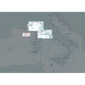
1-2 weeks delivery time Nautical chart from Ombrone River to Argentario in the Ligurian and north-central Tyrrhenian Sea, issued by the Istituto Idrografico della Marina at scale 1:50,000 in 83 x 116 cm format.
|
$ 80.58
-
+
| ||
|
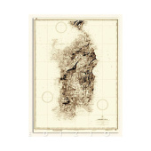
1-2 weeks delivery time Historical map of Sardinia Island (1890 edition) published by the Istituto Idrografico della Marina at scale 1:250,000 in 100 x 70 cm format.
|
$ 80.58
-
+
| ||
|
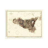
1-2 weeks delivery time Historical map of Sicily Island (1914 edition) issued by the Istituto Idrografico della Marina at scale 1:250,000 in 94 x 72 cm format.
|
$ 80.58
-
+
| ||
|
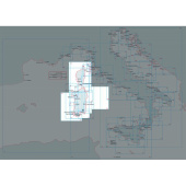
1-2 weeks delivery time Marine navigation chart from Golfo dell’Asinara to Passaggio dei Fornelli between Corsica and Sardinia, produced by the Istituto Idrografico della Marina at scale 1:50,000 in 116 x 75 cm format.
|
$ 80.58
-
+
| ||
How do nautical navigation tools assist in traditional marine navigation?
Nautical navigation tools play a crucial role in traditional marine navigation by helping sailors determine their position and plot accurate courses. Instruments like the marine navigation parallel ruler and nautical slide rule assist in chart plotting, while the divider solid brass drawing tool and protractor triangle with handle ensure precise distance measurements. Tools such as the star finder and compass aid in celestial navigation, making them essential for safe and reliable maritime travel.
In addition to essential plotting instruments, ship navigation tools include high-quality nautical accessories like the weems divider and the marine parallel ruler with clear scales, which help maintain precise alignment on nautical charts. Antique and vintage navigation straight pattern artist dividers, crafted from solid brass, provide both functionality and historical value, making them a preferred choice for traditional maritime navigation. Tools such as the quick reference navigation card and positioning triangle further enhance accuracy, assisting sailors in determining latitude and longitude efficiently. Collectible nautical decor items, such as deluxe binoculars and classic charting tools, blend practicality with a timeless aesthetic, making them valuable additions to any marine navigation toolset.
What are the primary functions of a nautical slide rule in marine navigation?
A nautical slide rule is an essential navigation instrument used for quick and accurate calculations of speed, time, and distance while sailing. It helps mariners interpret nautical charts, ensuring precise course plotting and route adjustments based on changing conditions. Commonly included in marine navigation tool kits, it complements other traditional tools like the parallel ruler and dividers for effective voyage planning.
How is a nautical chart used in traditional marine navigation?
A nautical chart is an essential tool in traditional marine navigation, providing detailed information about coastal features, water depths, and navigational hazards. Sailors use navigational instruments like the plath marine navigation parallel ruler, marine navigation nautical slide rule, and artist divider to plot accurate courses and determine positions. By following international navigation rules and using tools such as the parallel plotter and quick reference card, mariners can safely navigate through coastal and open waters.